

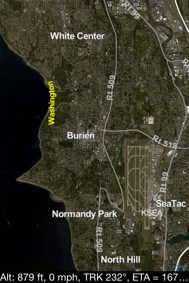
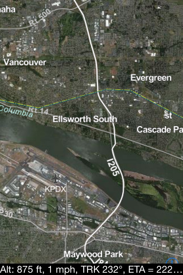

What are you flying over? What’s that lake or town? flyguide Pro displays what you are flying over with detailed satellite imagery. All Offline! Works just like an iphone/ipad GPS in your car. Uses GPS Tracking for a moving map display so you know exactly where you are.
When are you arriving at your destination? flyguide Pro displays your ETA to the destination airport, as well as altitude/groundspeed/heading and distance to destination.
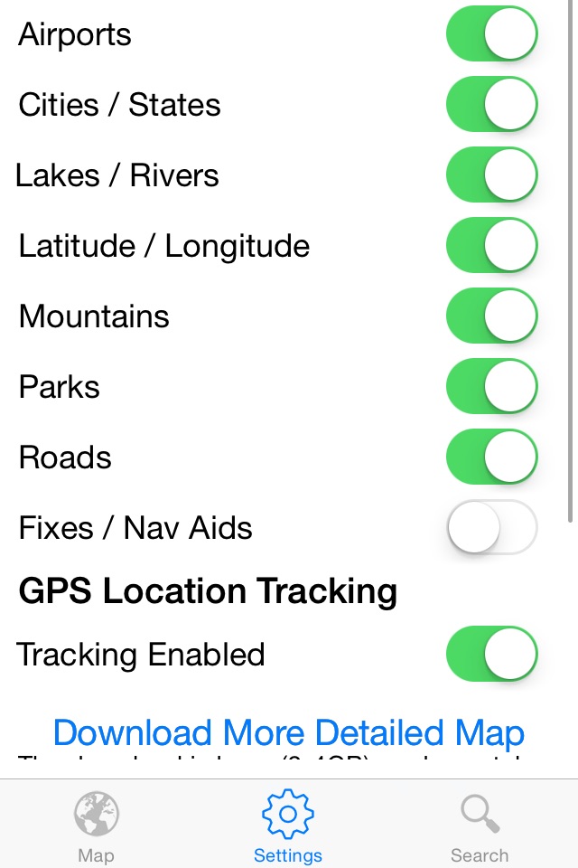
Labels Mountains, Lakes, Cities, Rivers, Major highways and much more!
Features included are:
- Displays the lower 48 United States.
- High resolution detailed map imagery.
- Moving map display.
- All Offline! No internet needed for use after download.
- Easy to use! Just open app and fly.
- Displays and describes unique points of interests.
- Displays interstates and highways.
- Search cities/towns and airports.
- Great app to use while driving on major roads if you don’t have a cell signal.
- Fully functional detailed map if your device isn’t GPS capable.
- Free separate download for even more detail.
Not to be used for navigation.
We strive to make the best app possible!
Comments or suggestions are appreciated.
notes:
- To utilize GPS tracking airborne on an ipad, the ipad must have Wi-Fi+Cellular capability.
- GPS tracking depends on GPS signal strength. The best location for reception is a window seat. The ipad has a larger GPS antenna which will acquire the signal faster. If you are having issues receiving a signal hold the top of the device (antenna location) against the window momentarily.
- Most airlines allow the use of a personal GPS device. Please check your individual airline’s policy.
- For more information or helpful tips go to www.flyguidebynovamedia.com